Lillooet → Osoyoos
Ten community nodes form the principal Phase I optical path, with site capacities sized to grid, fibre and heat-use constraints.
Phase I uses the sunny Interior corridor; Phase II adds the established greenhouse and food-processing ecosystem of the Fraser Valley.
Green = Phase I. Blue = Phase II. Gold dashed lines show resilience/future links under study. Exact routing is not yet selected.
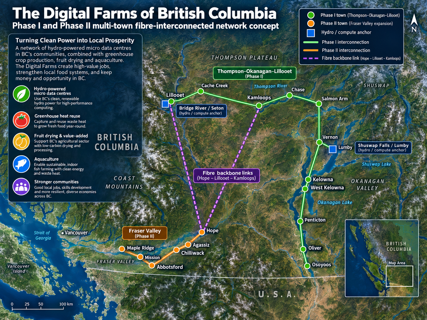
This is a pre-feasibility network. The map identifies screening communities, not acquired properties, approved projects or final fibre routes.
Ten community nodes form the principal Phase I optical path, with site capacities sized to grid, fibre and heat-use constraints.
Five agricultural communities connect west to a Metro Vancouver fibre exchange while preserving local heat-use opportunities.
A western inter-phase link plus future Lumby and Revelstoke spurs create options for failover, traffic engineering and expansion.
Large AI campuses concentrate electrical, water, permitting and community impacts. The Digital Farms model instead treats capacity as a portfolio of smaller sites that can be deployed where three conditions overlap: power, fibre and a productive heat sink.
The concept assumes dedicated long-haul fibre and wavelength services between sites. Latency-sensitive workloads remain local or regional; training and batch workloads can be scheduled across the fabric where software and hardware architectures permit. Final topology would require carrier surveys, dark-fibre availability checks and network engineering.
No site capacity is assumed available merely because a transmission line is nearby. Each node requires a utility interconnection study, protection design, substation capacity review, queue timing and, where necessary, staged build-out.